
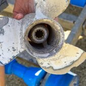
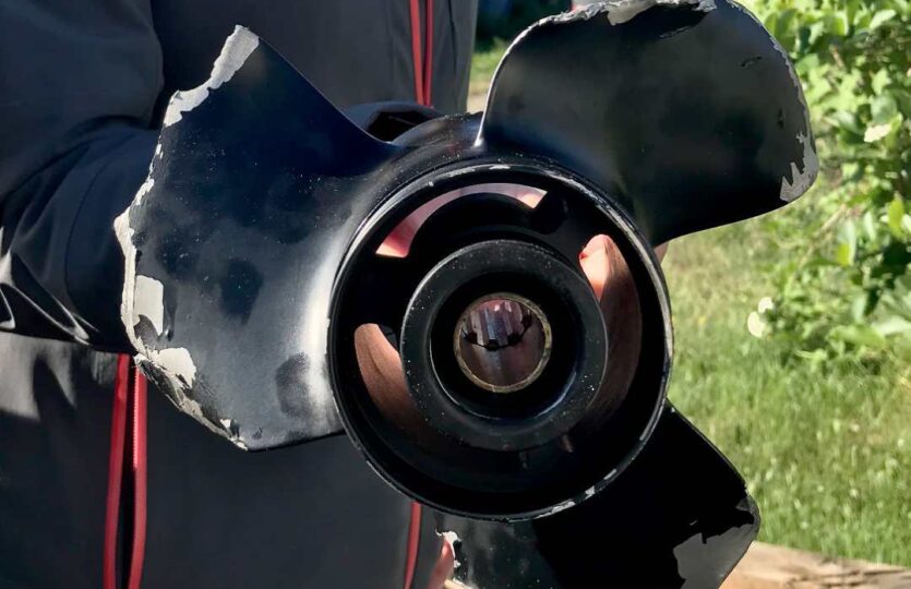
I would like to inform you that we have managed the feat of running aground in Öregrundsgrepen where the shoal unfortunately was not marked on the nautical chart!
Position of the shoal: 60.25,76 N and 18.15,71 E. Our boat, a sailboat, has a draft of 1.85 meters and there was quite extensive damage to the boat, a Hallberg Rassy 34. Fortunately, no personal injuries!
The nearest shallow area is a little less than 1/2 nautical mile away.
The Navionics chart for the Raymarine plotter does not show the shoal either, of course.
Weather
 Wind
Wind
 26 km/h
N(347.2°)
 Swell
Swell
 Height
--
 --
--
 14°C
14°C
