
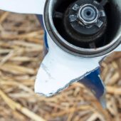
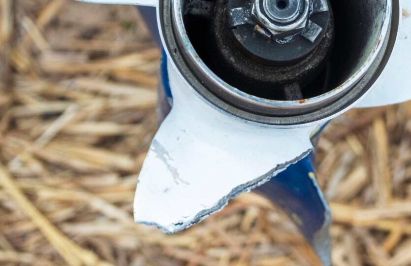
In the southern part of the entrance to Norrängsfladen (south of Brännäset), there is an underwater rock that is not marked on the chart. It is estimated to be on the boundary between the 3- and 6-meter contour lines, slightly east of the line between the headlands that limit the bay to the west. The depth over the rock is about 1.6 meters at the water level on the current day. We were anchored in the bay and saw a sailboat hit the rock when entering from the south. The depth is an estimate based on the size of the approaching sailboat.
Améen/Hansson describes the anchorage bay (Norrängsfladen) in their classic “Sailing Harbors on the East Coast.” But they did not sound far enough out in the bay’s mouth to discover the rock/shoal!
Weather
 Wind
Wind
 34 km/h
 Swell
Swell
 Height
 --
--
 15°C
15°C
