
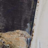
This was an unexpected place to encounter a shoal. The shoal is located approximately on the 6-meter contour line, and it’s far from the nearest 3-meter contour line. According to the nautical chart, the deepest passage between the islands appears to be roughly in the middle, but that’s where the shoal is. We ran aground where it was about 1.6 meters (with the water level that day), but the shoal was large, and right next to the boat it looked much shallower, perhaps down to 0.5 meters.
A check afterwards showed that the shoal is clearly visible on satellite images on Google Maps.
In the surrounding area, many shoals are marked, and the nautical chart gives the impression that the area is surveyed, so one might easily believe that it is relatively safe where the shoal is located.
We have been informed that another boat went to the same place the day before we were there, but they were lucky to miss the shoal both on the way in and out.
Of all the errors we have discovered in the nautical charts in Roslagen, this is the most serious error, and surely more groundings can be prevented if this shoal is included in the nautical charts.
Weather
 Wind
Wind
 48 km/h
 Swell
Swell
 Height
 Rain, Partially cloudy
 --
--
 12°C
12°C