
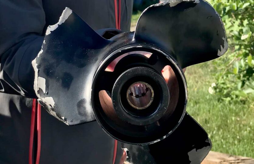
There is a shoal that is not marked on any nautical chart, nor when checking Eniro’s nautical chart. The shoal is about 1 meter below the water surface, but varies with high and low tide, with a peak that poses a risk of running aground. The shoal is located near the shipping lane where larger boats transport goods to and from Hallstavik’s paper mill.
60 degrees 8651 N, 18 degrees 32.717 E
Weather
Failed to fetch weather forecast data (HTTP 429).

